


A monster winter storm took aim at the Upper Midwest on Tuesday, threatening to bring blizzard conditions, bitterly cold temperatures and 2 feet of snow in a three-day onslaught that could affect more than 40 million Americans.
The storm was to begin around midday and continue through Thursday morning, dumping heavy snow and ice over parts of the Dakotas, Nebraska, Minnesota, Iowa and Wisconsin. The wind might hit 50 mph in some places.
The snowfall could be historic, even in a region accustomed to heavy snow. Total accumulation could hit 25 inches, with the heaviest amounts falling across east-central Minnesota and west-central Wisconsin, the National Weather Service said.
The Minneapolis-St. Paul area could see 2 feet of snow or more for the first since in over 30 years. More than a foot of snow was expected in the South Dakota cities of Sioux Falls and Pierre.
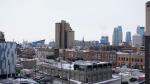
Some families scrambled to get shopping done before the weather closed in. At a Costco in St. Louis Park, Minnesota, 52-year-old Molly Schirmer stocked up on heat-and-serve dinners and Mexican Coca-Colas, knowing that she and her two teenagers might get stuck at home.
"The schools are already preparing to go online, so the kids will probably be home doing online school," Schirmer said of her 13- and 15-year-olds.
The weather service said the blizzard will actually involve two rounds. For the Minneapolis-St. Paul area, the first blast arrives Wednesday afternoon with up to 7 inches of snow. Round 2 starting later Wednesday and extending into Thursday is the real whopper, "with an additional 10 to 20 inches expected."
Weather service meteorologist Frank Pereira said the system was expected to affect about 43 million Americans.
Forecasters warned of life-threatening conditions, with bitter cold and strong winds bringing danger beyond the snow.
Temperatures could plunge to minus 15 to minus 20 degrees on Thursday and minus 25 degrees Friday in Grand Forks, North Dakota. Wind chills may fall to 50 degrees below zero, said Nathan Rick, a meteorologist in Grand Forks.
Wind gusts of 35 mph will be common and could reach 50 mph in western and central Minnesota. That will result in "significant blowing and drifting snow with whiteout conditions in open areas," the weather service said.
According to the weather service, the biggest snow event on record in the Twin Cities was 28.4 inches from Oct. 31 through Nov. 3, 1991 — known as the Halloween Blizzard. The second-largest was 21.1 inches of snow from Nov. 29 through Dec. 1, 1985. The Twin Cities got 20 inches of snow on Jan. 22 and Jan. 23, 1982.
Hours before the snow was to start, the storm was already having an impact. Minnesota state lawmakers canceled all committee hearings scheduled for Wednesday and Thursday as well as the Thursday floor sessions. Since they don’t normally meet on Friday, legislators won’t reconvene until Monday.
Hardware store owners said residents were generally taking the forecast in stride.
At C&S Supply, an employee-owned hardware store in Mankato, manager Corey Kapaun said demand was high for salt and grit, but not for shovels, snow blowers or other equipment. He attributed that to the fact that winter is two-thirds over.
Kapaun said he’s sold 130 to 140 snow blowers and around 1,000 shovels this winter, when Mankato has seen more than 3 feet of snow.
"I think people are either prepared or they’re not," Kapaun said. "It’s usually the first snowfall of the year that gets a lot of attention. With a storm like this, I expected a little bit more, but we’ve already had a big year of snow already."
In Sioux Falls, Dallas VandenBos has owned Robson True Value hardware store for 48 years. His customers are used to the snow, but don’t necessarily trust the forecast.
"When we had that storm the first part of January, they told us we were probably going to get three or four inches of snow, and we got 18 inches," VandenBos said.
Sales of snow-related items haven’t really picked up, but VandenBos has a backlog of snow blowers to repair. Those bringing them in Tuesday were out of luck — they won't be ready for a week.
"They’re not going to get them in time for this snow," VandenBos said.
Forecasters at AccuWeather said the same storm system could result in icing across a 1,300-mile band from near Omaha, Nebraska, to New Hampshire on Wednesday and Thursday, creating potential travel hazards in or near cities such as Milwaukee, Detroit, Chicago and Boston.
Portions of northern Illinois, southern Michigan and southern New York state could get up to half an inch of ice, which could topple power lines and cause outages, AccuWeather said.
As the northern U.S. deals with a winter blast, record warmth is expected in the mid-Atlantic and Southeast — 30 degrees to 40 degrees above normal in some places. Record highs are expected from Baltimore to New Orleans and in much of Florida, Pereira said.
Washington, D.C., could hit 80 degrees on Thursday, which would top the record of 78 degrees set in 1874.
